From The Neolithic To The Sea: A Journey From The Past To The Present
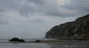
Reighton Sands
Statistics
Category
County
Coordinates
Grid
Condition
Age
Admission
County
Coordinates
Grid
Condition
Age
Admission
Beach
Yorkshire
54° 9' 29" N, 0° 16' 9" W
TA130750
Average
Unknown
Free
Yorkshire
54° 9' 29" N, 0° 16' 9" W
TA130750
Average
Unknown
Free
Map
- History
- Gallery
- Gallery
- Gallery
- Gallery
- Gallery
- Gallery
- Gallery
- Gallery
- Gallery
- Gallery
- Gallery
- Gallery
- Gallery
- Gallery
- Gallery
- Gallery
- Gallery
- Gallery
- Gallery
- Gallery
- Gallery
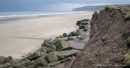
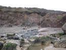
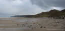
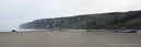
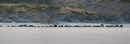
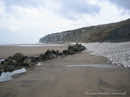
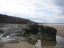
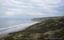
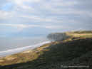
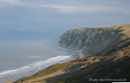
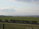
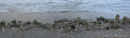
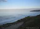
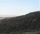
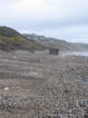
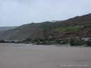
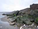
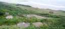
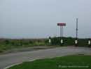
Reighton Sands lies below a caravan park of the same name. It is on the North East Coastline in the county of Yorkshire. Access to this beach is from the caravan park, but visitors are free to use the cliff top car parks and walk down to the beach, without being guests at the park. During the season, a day pass may be available from the park to use their facilities as well.
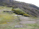
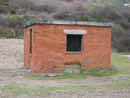
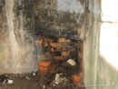
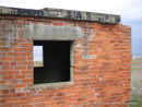
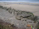
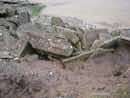
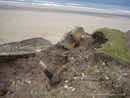
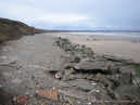
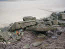
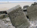
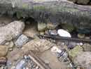
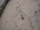
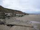
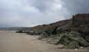
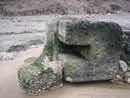
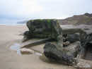
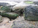
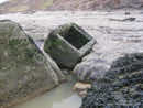
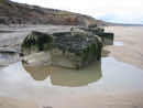
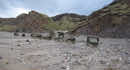
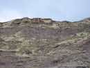
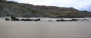
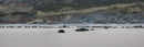
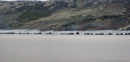
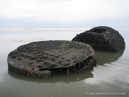
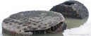
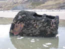
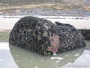
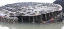
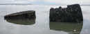
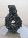
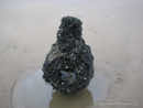
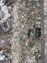
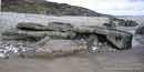
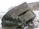
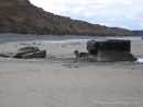
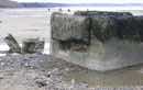
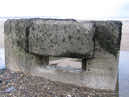
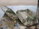
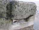
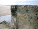
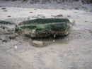
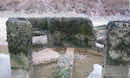
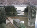
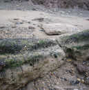
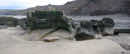
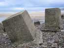
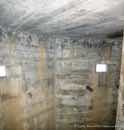
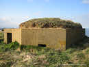
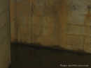
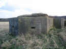
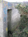
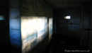
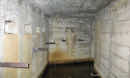
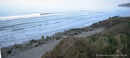
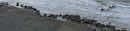
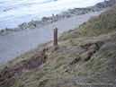
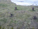
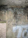
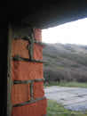
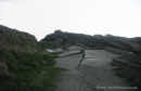
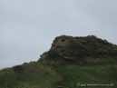
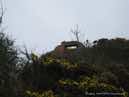
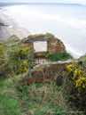
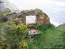
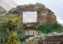
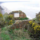
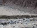
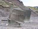
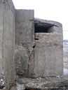
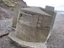
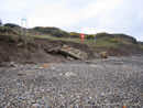
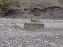
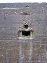
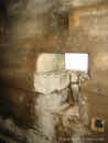
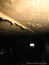
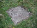
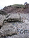
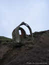
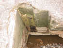
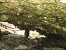
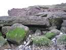
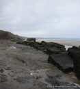
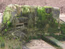
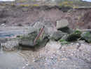
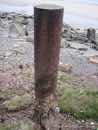
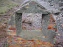
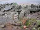
As military defensive position in WWII, the sands have remains of hastily prepared invasion defences. A Radar Station, gun emplacements, tank traps and pillboxes, amongst others, including mine fields which helped to form the basis of Britain's defensive lines. 3 types of pill box can be found, the Ruck machine gun post, the Eared pill box and the Lozenge pill box. The Eared pill boxes are in poor shape, as is the only surviving Ruck machine gun post. The Lozenge type pill boxes are in much better condition. Most are filled with water, from a few inches to a few feet. These boxes are still on the cliff top, at least 3 of the 8 Lozenge boxes are right on the cliffs edge and are under threat of tumbling to the beach like the Eared style boxes. Along the beach are remains of tank traps and the Eared style pill boxes. They are all jumbled up from erosion and the action of the sea. It is unclear how these were deployed.
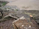
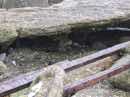
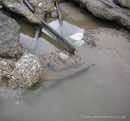
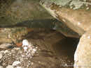
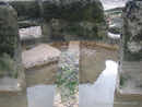
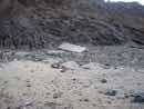
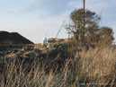
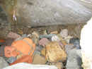
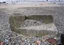
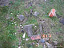
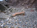
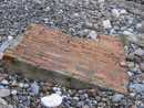
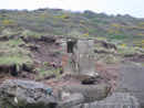
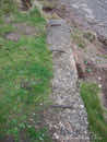
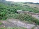
Some train tracks can be seen in the rubble. They were used as concrete reinforcement for a slipway which went down to the beech, used for the old gravel extraction plant, and have only become visible as the road crumbled. The sand and gravel was loaded by a mobile tracked crane, into small front tipping dumper trucks. These took the material to the washing plant part way up the cliff. The sand was washed out and dumped back into the sea. The gravel was taken away by Toulsons of Doncaster.
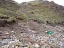
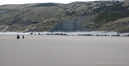
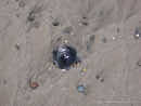
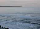
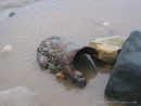
Occasionally pieces of aluminium, can be found on the beach, relating to aircraft lost in Filey Bay during WWII. An oxygen cylinder from a German Luftwaffe aircraft was found, dated to 1939. Probably from a Junkers JU88 as a number were shot down in the sea on 15th August 1940, whilst trying to bomb RAF Driffield. Two JU88`s also crashed at Speeton in July 1941. Shipwrecks can be found at low tide along the coast, including a submarine the "G3".
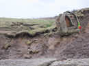
Hunmanby Gap is located next to Reighton Sands and continues on the WWII beach defences from Reighton Beach. The village name of Hunmanby originated with the Danes, appearing in the Doomsday book as 'Hundemanbi' meaning 'farmstead of the hounds men', relating to the hunting down of wolves on the Wolds. Evidence exists showing that Hunmanby was occupied by much earlier people than the Danes. A landslip occurred in 1907 revealing a British chariot burial site from the 1st or 2nd century BC, in which a chariot was buried horse and all. A tumulus on a local farm was opened up to reveal an ancient burial site containing 15 skeletons. Roman pottery and flint axe and arrow heads are frequently found in and around Hunmanby.
As military defensive position in WWII, the sands have remains of hastily prepared invasion defences. A Radar Station, gun emplacements, tank traps and pillboxes, amongst others, including mine fields which helped to form the basis of Britain's defensive lines. 3 types of pill box can be found, the Ruck machine gun post, the Eared pill box and the Lozenge pill box. The Eared pill boxes are in poor shape, as is the only surviving Ruck machine gun post. The Lozenge type pill boxes are in much better condition. Most are filled with water, from a few inches to a few feet. These boxes are still on the cliff top, at least 3 of the 8 Lozenge boxes are right on the cliffs edge and are under threat of tumbling to the beach like the Eared style boxes. Along the beach are remains of tank traps and the Eared style pill boxes. They are all jumbled up from erosion and the action of the sea. It is unclear how these were deployed.
Some train tracks can be seen in the rubble. They were used as concrete reinforcement for a slipway which went down to the beech, used for the old gravel extraction plant, and have only become visible as the road crumbled. The sand and gravel was loaded by a mobile tracked crane, into small front tipping dumper trucks. These took the material to the washing plant part way up the cliff. The sand was washed out and dumped back into the sea. The gravel was taken away by Toulsons of Doncaster.
Occasionally pieces of aluminium, can be found on the beach, relating to aircraft lost in Filey Bay during WWII. An oxygen cylinder from a German Luftwaffe aircraft was found, dated to 1939. Probably from a Junkers JU88 as a number were shot down in the sea on 15th August 1940, whilst trying to bomb RAF Driffield. Two JU88`s also crashed at Speeton in July 1941. Shipwrecks can be found at low tide along the coast, including a submarine the "G3".
Hunmanby Gap is located next to Reighton Sands and continues on the WWII beach defences from Reighton Beach. The village name of Hunmanby originated with the Danes, appearing in the Doomsday book as 'Hundemanbi' meaning 'farmstead of the hounds men', relating to the hunting down of wolves on the Wolds. Evidence exists showing that Hunmanby was occupied by much earlier people than the Danes. A landslip occurred in 1907 revealing a British chariot burial site from the 1st or 2nd century BC, in which a chariot was buried horse and all. A tumulus on a local farm was opened up to reveal an ancient burial site containing 15 skeletons. Roman pottery and flint axe and arrow heads are frequently found in and around Hunmanby.